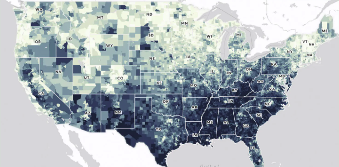
The U.S. Climate Vulnerability Index map is an interactive tool that ranks more than 70,000 U.S. census tracts using 184 indicators to show which communities face the greatest challenges from climate change. It visualizes “overall climate vulnerability” as well as underlying drivers in domains such as health, social and economic conditions, environment, infrastructure, and climate impacts (e.g., extreme events and climate disaster costs). Users can search for any location, compare tracts within a state or EPA region, and drill down to see which specific factors—like housing quality, exposure to pollution, or health burdens—are contributing to vulnerability, helping communities and decision‑makers target climate resilience investments where they are needed most.
Case study of a partnership between Maryland Department of the Environment and Cheverly, Maryland to use data from a hyper-local air sensor network and local traffic data to target air emissions inspections.
Report providing evidence-based guidance to inform local actions to reduce air pollution and its impacts on health. Includes interventions to address mobile sources, buildings, industrial sources, agriculture, and individual behavior.
The Climate and Health Program uses CDC's Evaluation Framework to monitor and evaluate the effectiveness of climate and health work. To highlight the evaluation planning process for climate and health, the program has translated the steps of the CDC Evaluation Framework into a video series. The videos showcase best practices evaluators can apply, as well as some common challenges, using real-world examples of today's most pressing climate threats, namely heat, flooding, and insect vectors.
This page provides resources for measuring transportation greenhouse gas emissions and air quality impacts, and incorporating climate adaptation and resilience features as they relate to a proposed project.
"BetterHubs aims to use a set of core objectives to help governments, companies, investors, and local communities design and engage with Hub projects in a way that sets a new bar for industrial innovation."
Air sensor monitors that are lower in cost, portable and generally easier to operate than regulatory-grade monitors are widely used in the United States to understand air quality conditions. This website provides the latest science on the performance, operation and use of air sensor monitoring systems for technology developers, air quality managers, participatory scientists and the public. The EPA is involved in the advancement of air sensor technology, including performance evaluations of sensor devices and best practices for effectively using sensors. The information can help the public learn more about air quality in their communities.
"The National Environmental Public Health Tracking Network (Tracking Network) brings together health data and environmental data from national, state, and city sources and provides supporting information to make the data easier to understand. The Tracking Network has data and information on environments and hazards, health effects, and population health."
Subscribe
Sign up to get the latest updates on new city clean air tools and resources.