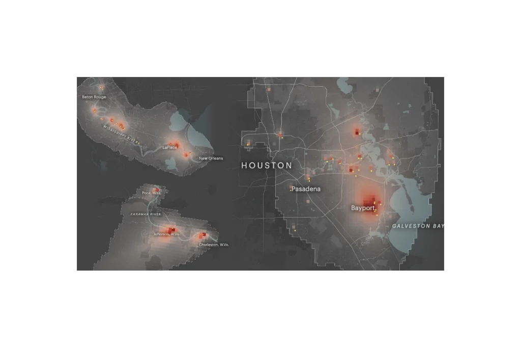
ProPublica’s Toxmap is an interactive map that visualizes estimated cancer risk from industrial air pollution across the United States. Built from EPA emissions and modeling data, it shows how toxic chemicals from thousands of facilities spread into surrounding neighborhoods, highlighting hotspots where cumulative industrial air pollution may raise cancer risk to levels the government considers unacceptable. The site lets users zoom to specific communities, see which facilities are driving risk, and explore patterns of environmental injustice in overburdened areas.
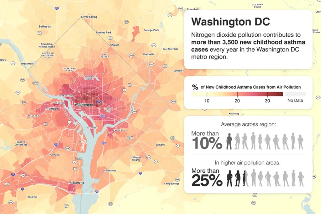
Nitrogen dioxide pollution contributes to approximately 3,500 new childhood asthma cases every year in the Washington D.C. metro region.
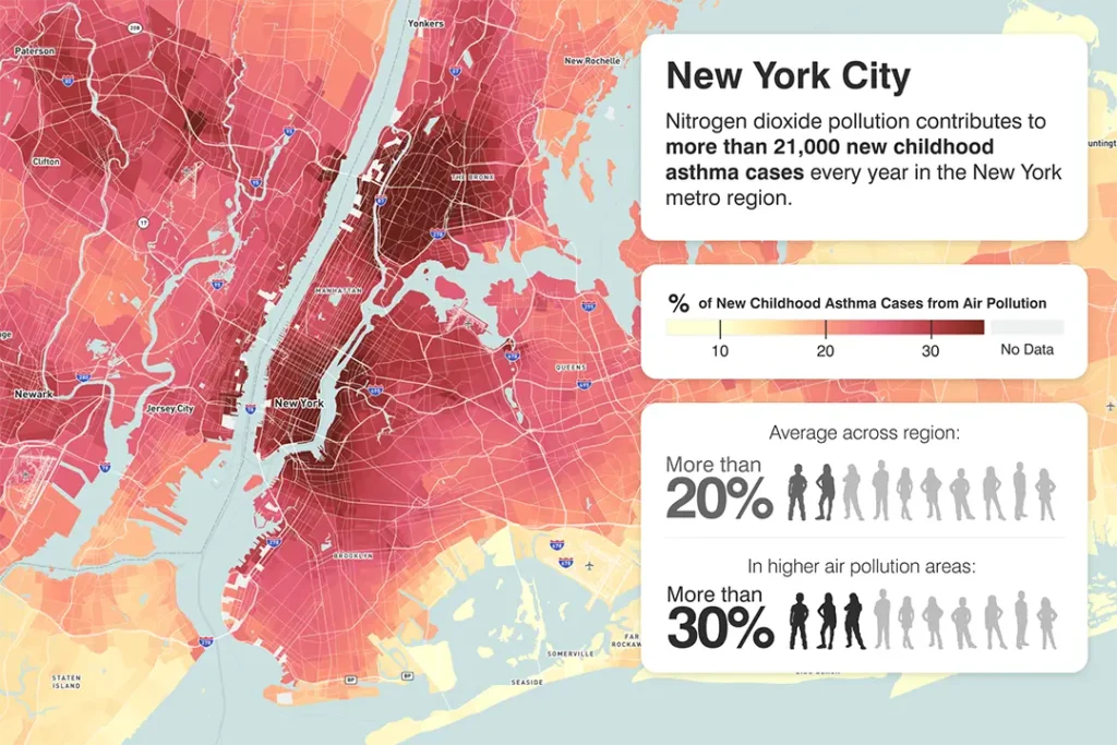
Nitrogen dioxide pollution contributes to approximately 21,000 new childhood asthma cases every year in the New York metro region.
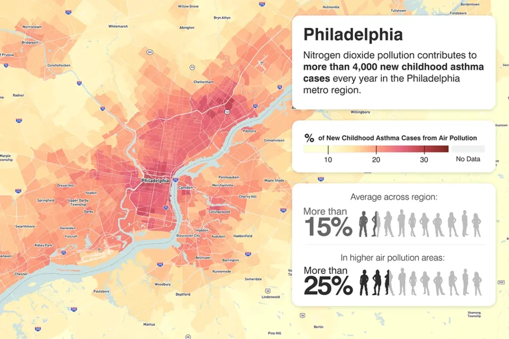
Nitrogen dioxide pollution contributes to approximately 4,000 new childhood asthma cases every year in the Philadelphia metro region.
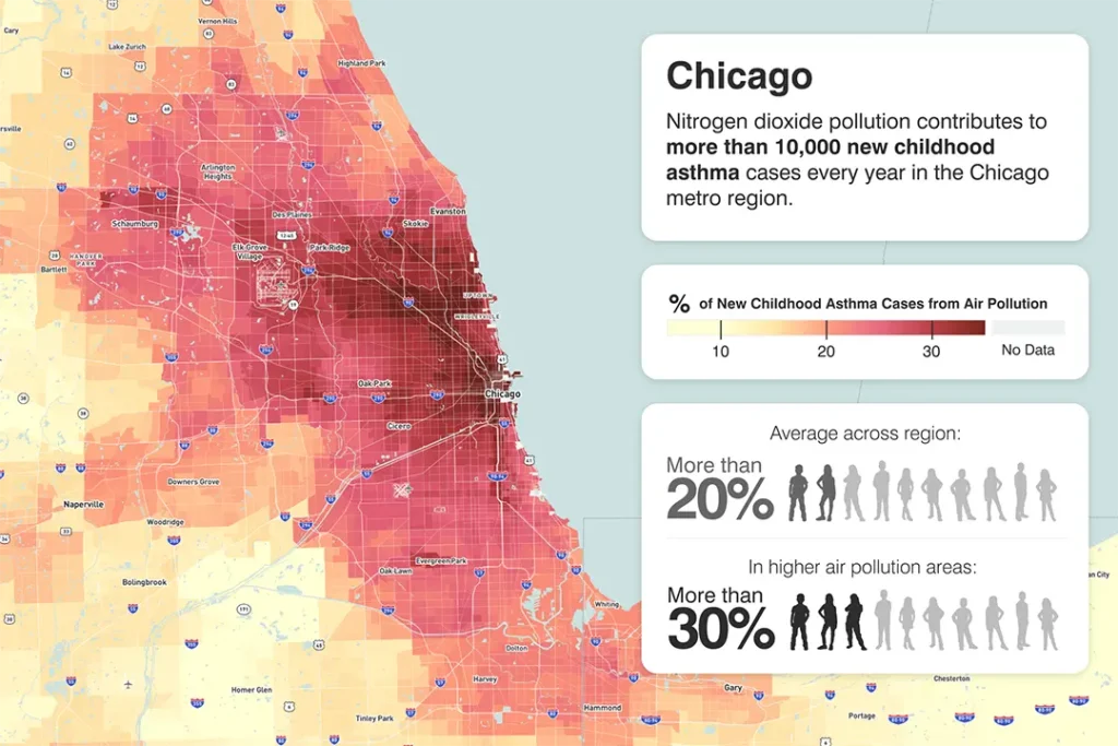
Nitrogen dioxide pollution contributes to more than 10,000 new childhood asthma cases every year in the Chicago metro region.
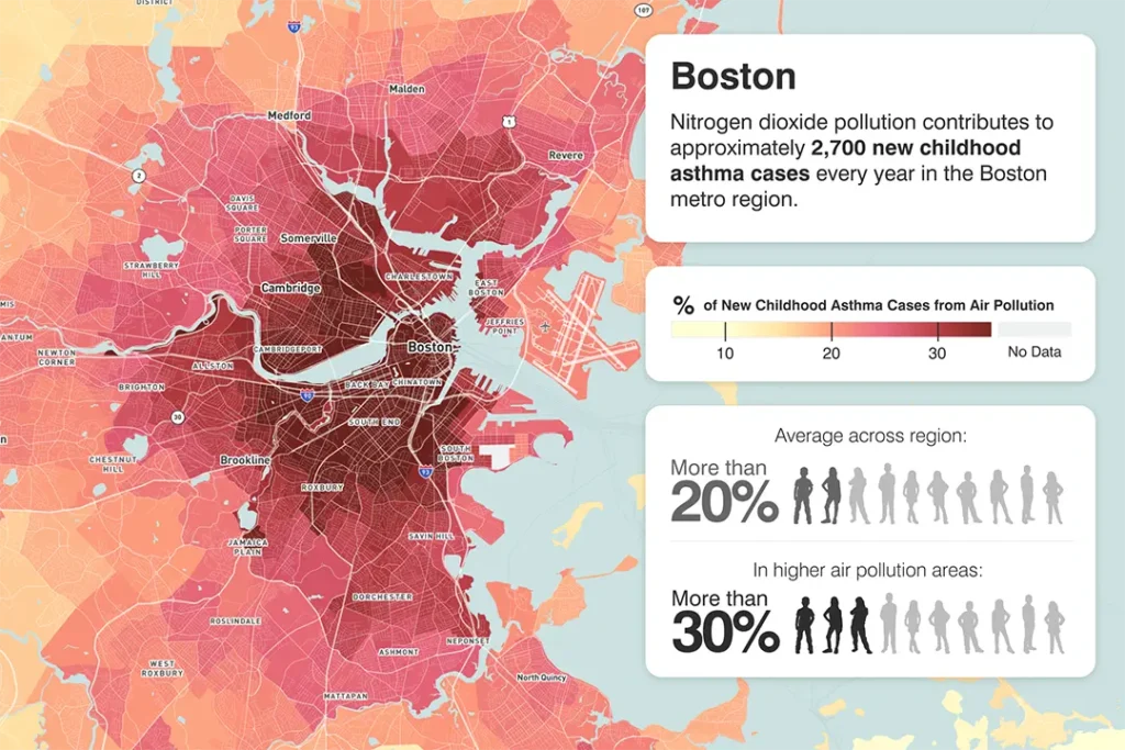
Nitrogen dioxide pollution contributes to approximately 2,700 new childhood asthma cases every year in the Boston metro region.
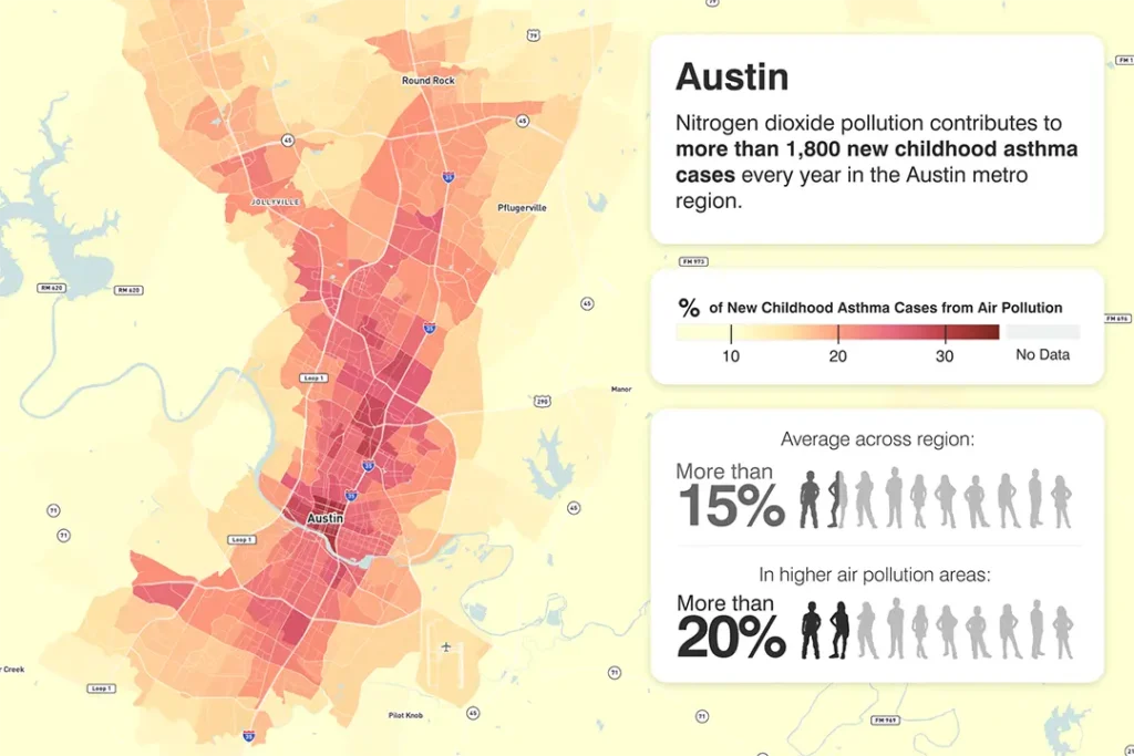
Nitrogen dioxide pollution contributes to more than 1,800 new childhood asthma cases every year in the Austin metro region.
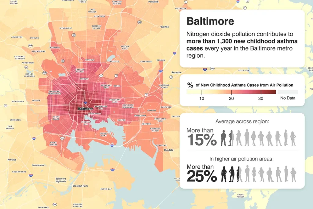
Nitrogen dioxide pollution contributes to more than 1,300 new childhood asthma cases every year in Baltimore metro region.
Subscribe
Sign up to get the latest updates on new city clean air tools and resources.