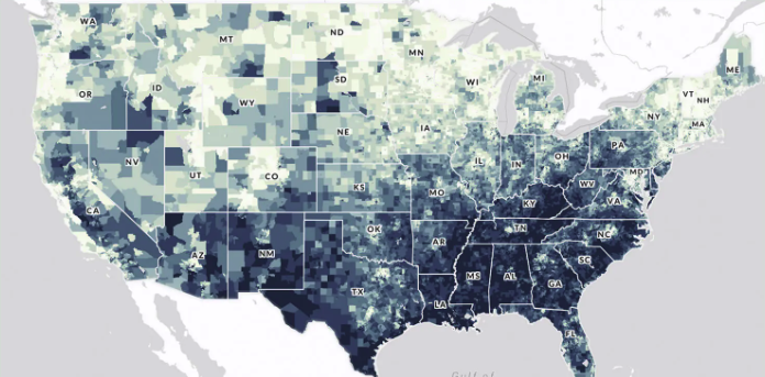
High-resolution, map-based decision-support tool launched in Fall 2023. It was co-developed by the non-profit American Forests alongside a council of local stakeholders, including city governments, state agencies, and community advocates.
Questions this resource can help answer
It is used by the City of Phoenix (specifically in their Shade Phoenix plan) and other municipalities to ensure that limited planting budgets are directed toward "heat-vulnerable" and historically marginalized communities.
How do I use this resource?
An easy-to-use tool to identify gaps in tree coverage